(Editor’s note: This is the first of two posts about exploring the Mae Hong Son Loop by motorcycle.)
When people think of Thailand, a few classic images come to mind: the soaring skyscrapers and unstoppable energy of Bangkok, the perfect beaches of Phuket and its surrounding islands and, of course, elephants. Having done very little (or no) research into Thailand before arriving, that’s all I knew also.
But as we settled into our hostel in Bangkok, it seemed like a lot of people were planning on heading north, into the densely forested mountains and valleys dotted with temples and waterfalls. After speaking to a few more people, we learned about a driving loop in the north of the country starting and ending in Chiang Mai (the largest city of the region and eighth-largest city in the country), which would allow us to explore the untouched countryside.
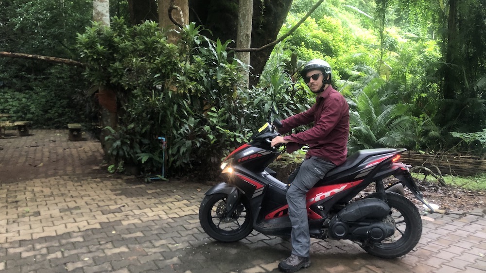
After taking the night train from Bangkok to Chiang Mai (20 euros, great beds, extremely clean and quiet – lovely!), we found a place to rent a moped, which as in the rest of Thailand was extremely easy as every other shop seems to offer them. Be aware that not all rental shops offer vehicle insurance and helmets included, so do a bit of research first. We were recommended to rent a stronger 250cc moped rather than the weaker, Vespa-style scooters as the mountain roads are very steep and with two people and backpacks on board, a little extra power going up those mountains was definitely necessary.
So, after consolidating our luggage into one backpack for a week on the road, strapping our helmets on and applying a liberal layer of suncream, we were ready to go.
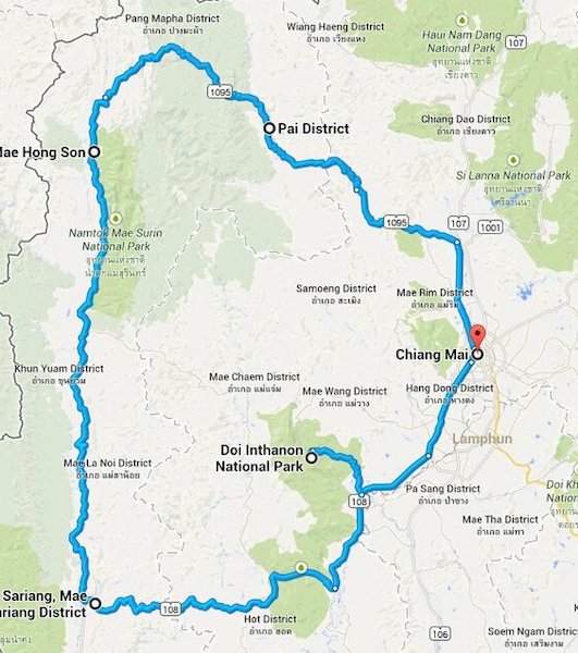
600 miles, 1,864 curves
The Mae-Hong-Son Loop is a 600-kilometer loop following three or four different roads starting and ending in the city of Chiang Mai. The route is very popular for its stunning views, small roads through mountain villages and its 1,864 curves, a dream for many motorcyclists! On top of this, the roads are almost brand new, so extremely easy to ride, and there is very little traffic on the way.
In fact, unless we were in larger towns, most of the time we had these beautiful roads completely to ourselves, which was a dream.
The loop can be completed in two to three days but that would mean few stops and riding nine hours per day (a moped doesn’t go so fast after all). We chose to take six days to return to Chiang Mai, with four days of riding and days in between to explore and relax.
Logistically, we found it was possible to ride 50 to 60 kilometers per hour comfortably on the larger roads, and then of course more slowly and carefully around the steep mountain curves or during rain storms.
It cost about 120 Thai Baht to fill the fuel tank (about 4 euros), which because of our larger moped and carrying two people up steep mountain passes, we did about every 1.5 days. It is important, however, (especially on the second and third day of driving) to fill the tank up when you leave a larger town, as it is not always possible to find gasoline in all of the smaller villages in the mountains.
The moped cost 250 Baht a day throughout the trip, about 40 euros for the entire week.
Popular, but not ‘touristy’
Although Chiang Mai is popular with tourists and backpackers, it does not feel “too” touristy unless you are at one of the popular bars in the centre. The city manages to balance the typically-Thai historic centre filled with hotels, restaurants, bars and tour companies for tourists with an energetic and vibrant “real” city surrounding it. In this way it is one of these perfect tourist cities that hosts all conveniences for traveling while maintaining its genuine character.
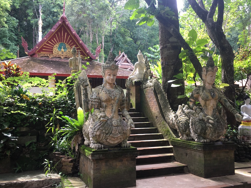
Many people spend time relaxing in the cafes or bars while taking day trips out to the countryside temples and surrounding hills. I recommend the Monk’s Trail to the west of the city, a short little hike up through the jungle to an incredibly beautiful and peaceful temple complex overlooking the city.
DAY 1
Once starting the loop, we left Chiang Mai via the southern highway (fortunately, the only highway driving during the trip) and after 45 minutes turned onto the country roads towards Doi Inthanon National Park. Entering the park, you start to get a taste of how steep some of these roads are and the need for so many sharp curves.
After climbing into the heights of the park, you can turn off of the main road and head towards Doi Inthanon itself, the highest peak in Thailand at 2,560 meters. Unfortunately, as we were in Thailand at the edge of the rainy season, we chose not to make the extra effort as the summit was completely shrouded in heavy fog. So, we continued back down the other side of the mountain range (more 8-percent inclines!), and headed towards the small river-side market town of Mae Chaem.
DAY 2
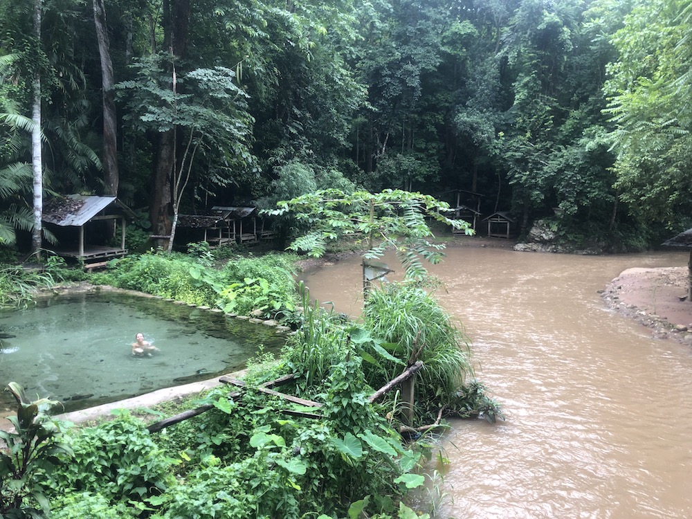
After a relaxing night’s sleep in a local homestay and a delicious evening meal of “as-you-order” barbecue meat and mushrooms in a family restaurant on the main road, we continued our trip. Now heading north, we first stopped 10 minutes outside town for a brief bath at the Mae Ok Hu hot springs, a small pool hewn out of the rock next to a curve in the Uam River. Although not very hot, we were pleasantly surprised the spring pool was filled with Garra Rufa – Doctor Fish – the same type of fish that nibble on your dead skin in fancy spa treatments.
Finally, a pedicure for free!
As we continued into the hills, the roads became narrower and steeper, curving across the ridges over high hills and overlooking the sweeping valleys of rice paddies ringed by dense forest. The roads in this area between Mae Chaem and Mae Hong Son were relatively empty with only a few logging trucks and mopeds stacked with families passing by.
As the roads here were less clearly marked, we were happy to have our month-long unlimited 5G Thai SIM card (purchased in a hostel when we arrived for 7 euros) that allowed us to use Google maps all over the country. Although, as we were driving through villages, helpful villagers also simply pointed us in the right direction as we cruised by.
As in the rest of Thailand, people were always ready to help and give guidance when needed. Although we were lucky with the weather in general, we did get caught in a few rainstorms and so our speed remained pretty low on the steep, curvy wet roads. But with views like this, there was no need to rush!
After descending from the high hills and ridges, we joined a main road (also perfectly maintained and relatively empty) heading to Mae Hong Son.
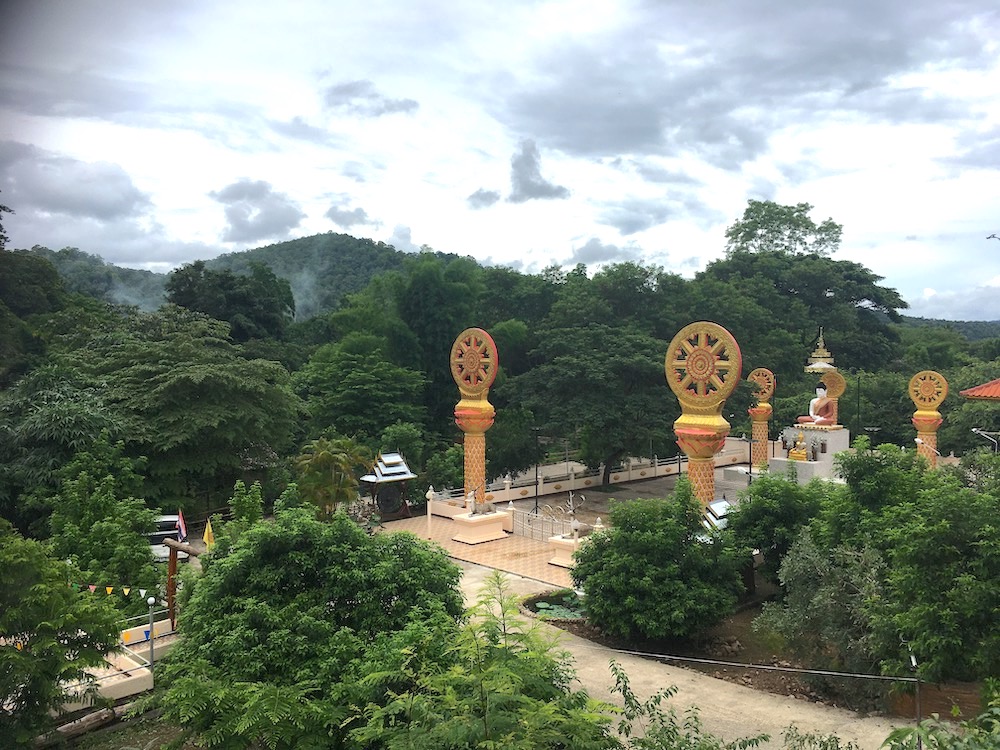
We stopped for a rest and to refuel at the temple of Wat Mae Surin, a beautiful complex overlooking a peaceful river, before continuing to the Pha Bong viewpoint which is positioned to look towards a valley opening through the mountains in the direction of Doi Inthanon.
After a quick coffee to re-energize after six hours of riding (slower than normal due to the rain) we entered the delightfully simple town of Mae Hong Son, the middle-point of the loop and the half-
way point in our adventure.
––––––––––
Read more of Thom’s post here in Dispatches’ archive.

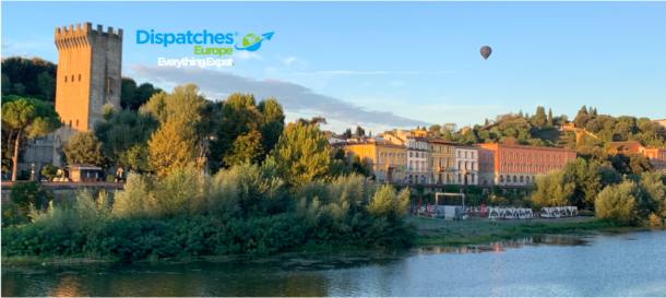
Thom Harding was born and raised in the UK and USA, sharing his time between Bath and Boston. Upon completing his studies in Art History and Painting in Florence, Thom travelled around Mexico and India before moving to New Mexico to start his career as a Primary school teacher.
After completing his MA in Education, he now lives and works in Vienna, Austria and enjoys spending his free time hiking, reading, travelling and exploring around Europe.
See more of Thom’s work here in the Dispatches archive.
You can read more about Vienna here in the Dispatches archives.